
Sitework Estimating Services for Civil Contractors
Send your civil plans for itemized earthwork, underground utility and paving quantities across CSI Divisions 31, 32 and 33. Request a quantities-only takeoff for your own rates or a priced estimate with an agreed cost basis. Your written proposal confirms the scope, fee and delivery date before work starts.
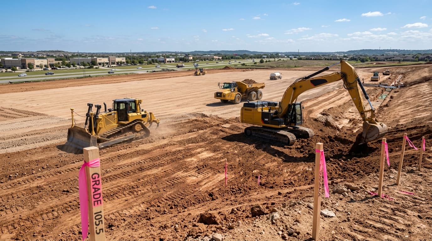
Choose the sitework scope you need priced
Send the current civil drawing set, project location, available geotechnical report and bid deadline with its time zone. Include utility profiles, paving sections and all issued addenda.
Quantities for your rates
Request measured quantities, units, drawing references and separately identified allowances so your team can apply supplier quotations and production rates.
A priced sitework estimate
Identify the labor, equipment, materials and subcontract pricing you need. Confirm the cost basis, assumptions and revision coverage in the proposal.
Before work starts: agree the included trades, output formats, fee and delivery date. Specify heatmaps or native surface files separately.
Earthwork takeoff scope · Utility takeoff scope · Paving quantities
Select your upcoming bid scope to preview required drawing sheets and standard deliverables:
- ✓Sheet C-101: Existing Topography & Tree Clearing Limits
- ✓Sheet C-201: Existing vs. Proposed Grading & Surface Contours
- ✓Sheet C-301: Storm Drainage Profiles, Inlets & Retention Details
- ✓Sheet C-401: Pavement Schedule, Asphalt & Curb Details
- ✓Geotechnical Soils Boring Log (for rock refusal & shrink/swell)
What Are Professional Sitework Estimating Services?
Sitework estimating services measure earthwork, underground utilities and exterior improvements from issued civil drawings for contractor bid review. Quantities and units are kept separate from labor, equipment and material pricing. The proposal should identify the drawing issue, measurement basis, exclusions and requested output for Divisions 31, 32 and 33. Cut/fill surface models, heatmaps and machine-control files require separate scope and file-format confirmation; the published quantity excerpts do not demonstrate those model outputs.
Civil Sitework Scope Breakdown (Divisions 31 • 32 • 33)
Every quantity takeoff is organized by MasterFormat specifications to help identify bid-day omissions and match general contractor tender packages:
The True Cost of an Inaccurate Earthwork Takeoff
In civil and sitework construction, the ground holds the highest financial risk. A simple 3,000 CY calculation discrepancy on export trucking can wipe out an entire subcontractor's profit margin before foundation work even begins.
Dirt Imbalance & Trucking Costs
Assuming a balanced site when 4,500 CY of export is required means unexpected trucking, disposal tipping fees, and machine idle time. We model cut/fill down to the exact subgrade offset.
Underground Utility Scope Gaps
Missing trench depth stratification (0-6', 6-10', 10'+), rock excavation strata, or granular bedding requirements leads to under-bidding high-risk storm and sanitary installations.
Bid Crunch & High Software Overhead
Outsourcing a defined takeoff scope can support contractors during busy bid periods. Confirm capacity, file requirements and delivery dates for each project.
Comprehensive Sitework Takeoff Services
Built strictly around CSI MasterFormat specifications to seamlessly integrate with your bidding spreadsheets, unit-rate databases, and subcontractor proposals.
3D Earthwork Cut & Fill Takeoffs
Comprehensive 3D surface modeling comparing existing topographical survey contours against finished civil design elevations. We account for topsoil stripping, subgrade section depths, building pads, and retention ponds.
- Cut/Fill Summary: Gross Cut, Gross Fill, Topsoil Stripping & Respread
- Color Heatmaps: Visual cut/fill depth mapping for site superintendents
- Mass Haul Analysis: Net export/import volumes & internal haul balancing
Underground Site Utility Estimating
Itemized quantification of wet and dry utilities. Every pipe run is measured with invert elevations, depth brackets, trench excavation, bedding stone, and backfill volumes.
- Storm Drainage: RCP, HDPE, PVC pipe LF, curb inlets, catch basins & headwalls
- Sanitary Sewer: SDR-35 / PVC lines, precast manholes, drop connections & laterals
- Water Systems: C900 / DIP mains, fire hydrants, gate valves, tees & services
Grading, Paving & Exterior Hardscape
Accurate area and volume takeoffs for heavy-duty vs. light-duty pavement sections, subbase gravels, concrete flatwork, curbs, and perimeter erosion controls.
- Asphalt & Base: Surface course SY, binder course SY, crushed stone base TN
- Concrete Work: Standard & ribbon curbs LF, valley gutters, 4"-6" sidewalks SF
- Erosion Control: Silt fence LF, stabilized construction entrance, inlet protection
Civil Subcontractor Bid Preparation
Turn raw quantity takeoffs into clean, line-item bid proposals. We populate your custom unit costs or provide clear quantity schedules formatted to your general contractor's bid forms.
- Bid Form Alignment: Itemization mapped directly to Owner / GC bid schedules
- Scope Gap Analysis: Flagging conflicts between civil plans, specs & soils report
- Excel Integration: Dynamic formulas for labor, equipment & material rate changes
All 8 Commercial Sitework Estimating Disciplines
From Civil Blueprints to Bid-Ready Quantities
Our estimating workflow reviews the issued elevations, pipe inverts and paving layers, and records unresolved drawing conflicts for your project team before bid review.
Submit Civil Plans
Upload your PDF drawings, CAD/LandXML files, and geotechnical boring logs via our portal with your bid deadline.
Scope Review & Quote
Our civil estimators review your drawing sheets, confirm the exact sitework scope (Divisions 31, 32, 33), and provide an upfront proposal.
3D Surface Modeling
We digitize existing topography and proposed finished design grades, calculating cut/fill, subgrade offsets, and utility trenches.
Senior QC & Delivery
A senior estimator audits the quantities for common errors and delivers full 3D color heatmaps, marked-up plans, and editable Excel files.
State Bid References and Scope Questions
Use sourced references to identify the governing documents and scope boundaries. Project investigation and approved plans establish the actual site conditions:
Contract Items & SWP3
Separate TxDOT contract items, local drainage interfaces and construction-stormwater responsibilities.
Read the Texas bid reference →Dewatering & Permit Interfaces
Check the project discharge method, construction-stormwater coverage and environmental-resource approvals.
Read the Florida bid reference →Letting Dates & Utility Scope
Reconcile specification dates and measurement units, then identify the local sewer or outfall connection requirements.
Read the New York bid reference →Standards & Stormwater Documents
Record the standards incorporated into the contract and measure the project-specific grading and stormwater details.
Read the California bid reference →Agree the sitework scope, measurement basis and handoff
A usable civil estimate separates measured quantities from contractor pricing and from any engineering or field-model deliverables. Use the proposal to define what is included.
Quantity takeoff or priced estimate?
Confirm whether you need measured quantities only or labor, equipment, materials and subcontract costs. Supply your production assumptions, local vendor rates, haul routes and disposal requirements for any priced scope.
Files and revisions
Specify the spreadsheet layout, drawing markups, required surface files, baseline issue and addenda. Confirm any special software or GPS export requirement before authorizing work; public quantity excerpts do not demonstrate a machine-control package.
Project-specific fee and delivery
The proposal should state the fee, included trades, exclusions, delivery date and revision terms after the drawings are reviewed. Include acreage, project location and the bid deadline with its time zone.
Review before bidding
Check plan references, units, allowances, cut/fill basis and missing design information. Keep rock, unsuitable soil, dewatering, temporary works, haul/disposal and testing allowances visible rather than hiding them in a single quantity.
Prepare your civil drawing set · Review a takeoff · Inspect actual quantity excerpts
Frequently Asked Sitework Estimating Questions
What is included in a professional sitework takeoff?
The agreed scope may cover clearing and excavation, grading, paving and concrete flatwork, plus underground water, sewer and storm drainage quantities. Deliverables identify measurements, units, plan references, allowances and exclusions so the contractor can review and price the work.
How much do sitework estimating services cost?
Fees depend on the drawing set, acreage, utility profiles, requested trades, revisions and deliverable formats. Submit the plans and bid deadline for a project-specific scope and fee proposal before work begins.
How quickly can an earthwork takeoff be delivered?
The delivery date is confirmed after reviewing the plans, scope, available information and current workload. Include your bid date and time zone when requesting a quote. Ask whether any expedited schedule is available for your project.
What files should I expect with a civil takeoff?
The published samples demonstrate itemized quantity schedules and a cropped civil drawing preview. Confirm editable spreadsheet formats, PDF markups and any requested surface-model exports in the proposal. A quantity takeoff is separate from a field-ready machine-control model or engineering design.
How are soil cut and fill volumes calculated?
Existing ground is compared with the proposed excavation or subgrade surface inside defined boundaries. Pavement and slab depths, stripping, unsuitable material and phased work are treated separately. Bank, loose and compacted volumes are identified, with project geotechnical factors stated rather than assumed to be interchangeable.
Why do subgrade deductions and soil factors matter?
Finished pavement elevations differ from earthwork subgrade elevations. As an illustrative geometry check, a one-foot section across 100,000 square feet represents 100,000 divided by 27, or about 3,704 cubic yards. Actual shrink, swell and reuse factors must come from the project information and be identified in the takeoff.
Which civil plan sheets are needed for a quote?
Provide the current civil drawing set, existing survey and grading plans, utility plans and profiles, pavement and structure details, specifications, available geotechnical report and all addenda. Sheet numbering varies by designer; identify the revision date and scopes you need priced.
How should revisions and scope discrepancies be handled?
Record the baseline drawing revision and addenda used for the takeoff. Compare changed limits, elevations, utility runs and details against that baseline. Confirm the revision scope and delivery date, and keep unresolved conflicts visible as assumptions or questions for the project team.
Submit Your Drawing Set for a Scoped Sitework Proposal
Upload civil drawings via link or direct form. Our senior estimators review plans, identify potential scope gaps, and issue a project-specific takeoff proposal.